
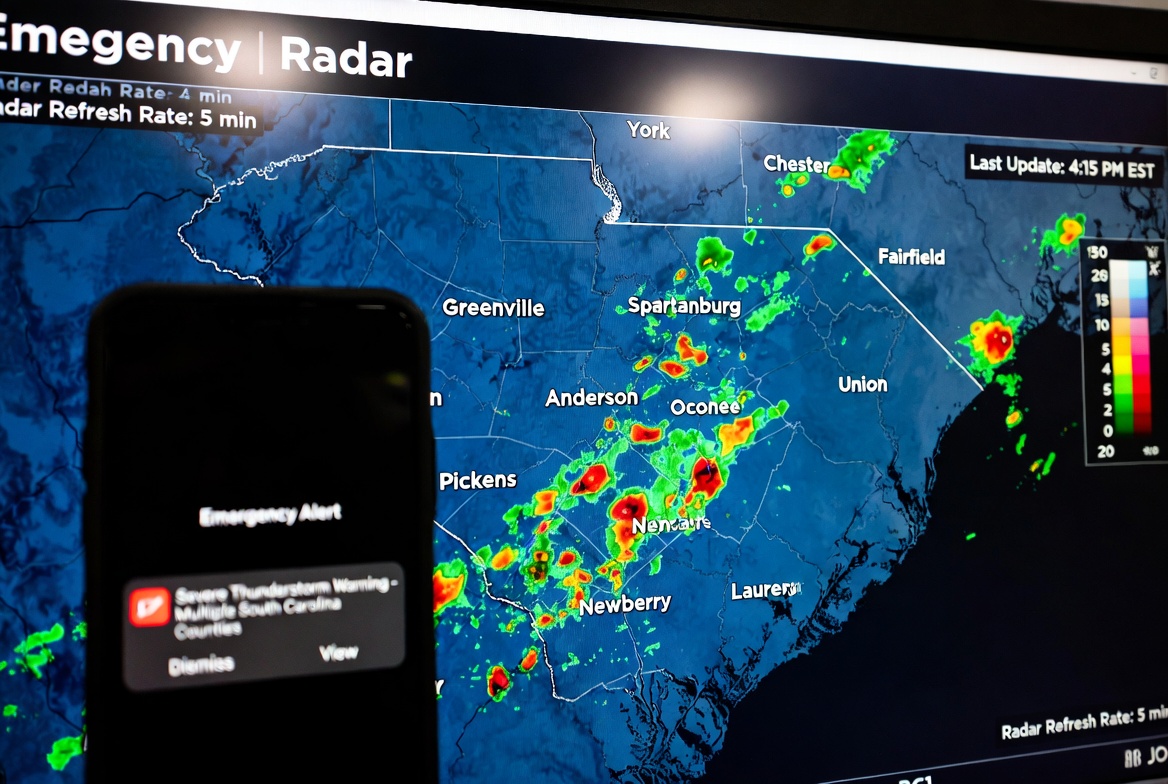
If you thought a quiet afternoon in South Carolina meant smooth sailing, think again. Across the state, multiple counties have recently been under severe thunderstorm alerts, sending residents running for cover, securing outdoor furniture, and double-checking their weather apps. These aren’t ordinary rain showers — we’re talking about strong winds, pounding rain, hail bouncing off car roofs, and lightning that lights up the sky like fireworks gone wild.
When the National Weather Service issues alerts covering multiple counties, it’s nature’s way of waving a big red flag. It signals that the storm systems moving across South Carolina aren’t content with a single town — they’re on a mission, spreading their reach from the Upstate to the Lowcountry, touching everything in their path.
Why South Carolina Sees Multi-County Thunderstorm Alerts
South Carolina sits in a unique weather hotspot. Warm, humid air streams up from the Gulf of Mexico and the Atlantic Ocean, colliding with cooler, drier air masses that push in from the north. When this atmospheric collision happens, it creates the perfect recipe for thunderstorms — and sometimes, storms so strong they merit alerts for multiple counties at the same time.
There are a few common reasons these multi-county alerts happen:
- Fast-moving cold fronts: When cooler air pushes into warm, humid air, it creates instability that fuels storm formation.
- Squall lines: Sometimes, storms organize into long lines stretching for miles. When these lines move across several counties, the alerts cover the whole path.
- Wind shear and atmospheric instability: Changing wind speeds at different altitudes can help storms organize into stronger, longer-lasting systems.
- Heavy moisture influx: Especially in spring and summer, moisture from the Gulf and Atlantic can feed thunderstorms, making them more intense.
In other words, South Carolina has all the ingredients for dramatic thunderstorms — and Mother Nature isn’t shy about using them.
What Happens During Multi-County Severe Thunderstorm Alerts
When alerts are issued across multiple counties, it means the storms could produce one or more of these hazards:
1. Powerful Winds
These storms often come with straight-line winds exceeding 58 mph. That’s enough to uproot trees, blow over fences, damage roofs, and leave neighborhoods without power. If you hear a roar outside like a distant train, it could be the storm testing its strength.
2. Hail
Hailstones can range from pea-sized to baseball-sized — small enough to surprise you, large enough to dent your car. And when a multi-county storm moves through, there’s no telling which areas might get hit hardest.
3. Heavy Rain and Flash Flooding
Even a short, intense storm can dump several inches of rain in under an hour. Low-lying areas, poor drainage zones, and riverside communities are especially vulnerable. A calm street can turn into a mini-river in minutes.
4. Lightning
Lightning isn’t just dramatic — it’s deadly. During multi-county severe thunderstorm events, lightning strikes increase dramatically. Being caught outside in these storms without shelter is risky business.
County Highlights: Who’s Usually in the Line of Fire
While storms can surprise anyone, some regions of South Carolina historically see more frequent multi-county alerts:
- Upstate: Greenville, Spartanburg, Anderson, and York counties often experience early-season storms because of hilly terrain and frontal interactions.
- Midlands: Richland, Lexington, Kershaw, and Sumter counties can see long lines of storms sweeping across several jurisdictions at once.
- Lowcountry & Coastal: Charleston, Beaufort, Colleton, and Jasper counties face storms fed by Atlantic moisture and sea breezes, often moving quickly and unexpectedly.
These patterns help meteorologists anticipate where multi-county alerts may be needed, but weather always retains an element of surprise.
Historical Examples of Multi-County Alerts
To understand the impact, it helps to look at past events:
- In one recent summer, a squall line moved through central South Carolina, triggering severe thunderstorm warnings for Richland, Lexington, Sumter, and Kershaw counties simultaneously. Residents reported wind gusts shaking homes and hail bouncing off cars, reminding everyone that a storm doesn’t care about county lines.
- In the Lowcountry, coastal counties like Charleston, Beaufort, and Dorchester have seen multi-county alerts when Atlantic moisture meets inland heat, forming thunderstorms that stretch across several jurisdictions in an hour or two.
These past events show how quickly a storm can escalate and why multi-county alerts are issued as a precaution — sometimes saving lives and property.
Understanding the Alerts: Watch vs. Warning
Many people get confused by weather jargon. Here’s a quick guide:
- Severe Thunderstorm Watch: Conditions are favorable for severe thunderstorms. Stay alert, keep tabs on weather updates, and prepare to act if needed.
- Severe Thunderstorm Warning: A severe thunderstorm is occurring or imminent. Take immediate shelter indoors, away from windows and doors.
During multi-county alerts, these distinctions matter because a warning could be in effect for one county while a watch covers neighboring areas, reflecting the storm’s path.
Tips for Staying Safe During Multi-County Storms
Even if the skies look calm, it’s wise to be prepared for storms that might travel across counties. Here’s how to stay safe:
- Stay updated: Use NOAA Weather Radio, official apps, or local news for real-time updates.
- Secure outdoor items: Bring in patio furniture, trash cans, or anything that could become dangerous in strong winds.
- Create a family plan: Know where to take shelter, how to communicate, and have supplies ready.
- Emergency kit: Keep flashlights, batteries, first-aid supplies, and non-perishable food accessible.
- Follow the 30–30 lightning rule: If you see lightning and hear thunder within 30 seconds, go indoors; wait 30 minutes after the last thunder before heading back outside.
Preparedness isn’t just common sense — it can make the difference when storms hit multiple counties at once.
The Science Behind Multi-County Storm Alerts
Modern meteorology relies on radar, satellites, and computer models to detect storms early. When a cluster of thunderstorms meets severe criteria, meteorologists draw warning polygons that often cross county lines. This is why multiple counties may see alerts simultaneously — it reflects the storm’s actual size and impact area, not an overreaction.
Weather models help predict where storms might form, but radar confirmation is usually what triggers the official alert. That’s why multi-county warnings can appear suddenly: storms can organize quickly, and alerts are issued in real time to protect residents.
Why South Carolina’s Thunderstorm Season Is Unique
South Carolina’s spring and early summer months are notorious for multi-county thunderstorms because of:
- High humidity: Moisture from the Gulf and Atlantic fuels storm intensity.
- Temperature swings: Warm surface air meets cool fronts, creating instability.
- Terrain diversity: From the Piedmont hills to the coastal plains, topography affects storm development and path.
All these factors mean that even when the weather looks calm, multi-county alerts may be just around the corner. It’s part of living in a state where nature likes to make an entrance.
Making It Mazedar: Real-Life Storm Moments
Imagine this: You’re sipping your coffee in Greenville when suddenly the sky darkens. The wind kicks up, branches bend, and hail begins pelting your car like tiny drums. A notification pops up: “Severe Thunderstorm Warning — multiple counties affected.” Your neighbors scramble to secure their porches, the dog whimpers inside, and for a moment, everyone in the neighborhood is connected — not through social media, but by the storm.
These moments may be stressful, but they also create shared experiences, stories, and a healthy respect for the unpredictable power of nature. Multi-county alerts are more than just notifications — they are nature’s call to pay attention, to prepare, and to appreciate the drama above.
Conclusion: Stay Alert, Stay Safe
Multi-county severe thunderstorm alerts in South Carolina are reminders that storms don’t respect boundaries. They sweep across towns, counties, and landscapes, bringing wind, rain, hail, and lightning. Understanding the alerts, knowing the hazards, and being prepared can make all the difference.
South Carolina’s weather is thrilling, sometimes chaotic, and always worth respecting. From the Upstate to the Lowcountry, residents should keep their apps ready, emergency plans updated, and a watchful eye on the sky. After all, you never know when the next storm will announce itself with a flash of lightning and a roar of wind that spans multiple counties — and suddenly, everyone is part of the same dramatic weather story.
✅ Key Takeaways:
- Multi-county alerts signal storms with wide-reaching impact.
- Severe hazards include high winds, hail, heavy rain, flash flooding, and lightning.
- Preparation — emergency kits, family plans, and weather monitoring — is essential.
- South Carolina’s geography and climate make it prone to these events, especially in spring and early summer.
- Stay alert, take warnings seriously, and respect the power of nature.